

RESEARCH PROGRAM 
Scientific program of the research station
The scientific program of the station follows up studies undertaken during the joint Czech-Kyrgyz expeditions. The establishment of the permanent research station upgrades the future investigations in several disciplines. The results achieved in the Adygine area will be a model for the whole of the west Tian Shan region and can be correlated with relevant results obtained in high-mountain areas worldwide.
The station is open to research projects of the Kyrgyz and Czech teams and also to scientists of foreign universities and research institutions.
Project proposals and research programs as well as suggestions for the use of the station can be submitted to contact persons given in these pages.
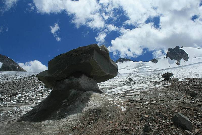
Glacier table on the Adygine glacier is one of the phenomena indicating melting.
Monitoring of hazardous lakes
The development of all lakes and changes in their size, shape and water level are continuously monitored. All changes in morphology of moraine dams, separation, landslides, collapses, etc. are also monitored. In case of emergency the relevant institutions will be immediately informed (Management of the National Park, Ministry of Contingent Situations.
Meteorological observations
Two weather stations were installed at the locality within the program of climate monitoring. One of them is situated near the building at lake level and the other one above the glacier at an elevation of 3 830 m above sea level. The thickness of snow cover and its temperature are also measured. The acquired data will serve for correlation of glacier development and all natural phenomena indicating dangers involved.
Hydrological studies
Hydrological research is an integral part of monitoring of the development of lakes and their inflows and outflows. A hydrological balance of lakes will be established based upon the measurements undertaken.
Glaciological studies
This investigation is intended to monitor all phenomena related to glacier retreat and changes in its volume.
Other investigations
In addition to studies carried out within the project, the station is open to Kyrgyz and foreign scientists for their projects that can be focused on seismology, atmosphere and the content of greenhouse gases, botany, etc.
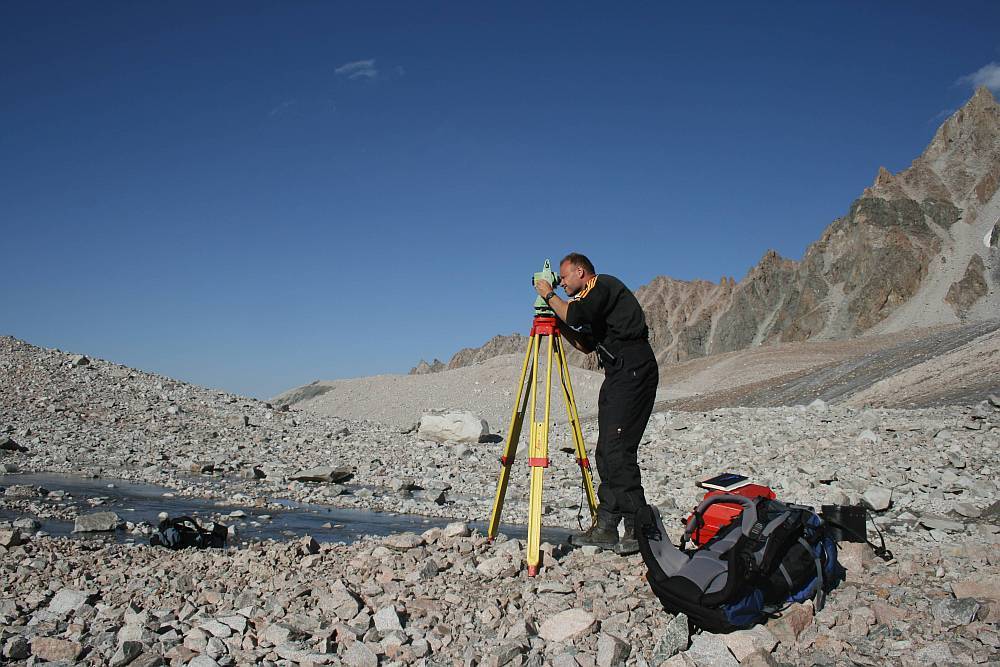
Surveying the glacier edge and marked profiles in its snout are carried out annually
Equipment for research programs
All equipment was purchased and supplied in the frame of projects undertaken and subsidized within the Czech Development Cooperation Program. The instrumentation will be progressively complemented in the course of time.
Climatology and meteorology
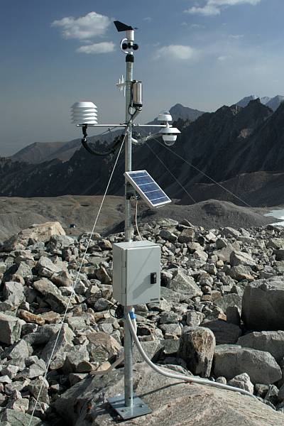
Climatological observations represent the principal part of the research program and both weather stations were installed to perform relevant measurements. A complete station equipped with sensors enabling it to measure 11 parameters (temperature, pressure and humidity of the air, direction and velocity of wind, atmospheric precipitation, solar radiation Albedo, and temperature of the ground at three levels) was installed on a crest above the glacier at an elevation of 3 830 m above sea level. It is currently the uppermost meteorological station in Kyrgyzstan and possibly even in the whole of Central Asia. The station automatically measures, records and transmits data via the GSM network to the Internet server. The station was installed in the neighborhood of an old summary rain gauge, which was fixed by ourselves and put into operation.
The other station is situated in the neighborhood of the research station building. A combined method of measurements is employed. The automatic station measures temperature, pressure and humidity of the air and direction and velocity of the wind. It can be complemented with other sensors. It is also equipped with an analogous bucket rain gauge and classic mercury thermometers (station, maximum, minimum). The classic rain gauge is useful for measuring winter precipitation when the measurements using a not heated electronic rain gauge are considered to be less reliable. The measurements of temperature by means of classic thermometers give slightly different values in comparison with values obtained by electronic thermometers but the dual data may be used for later correlation of data acquired by automatic stations that gradually replace the regular ones even in Kyrgyzstan.
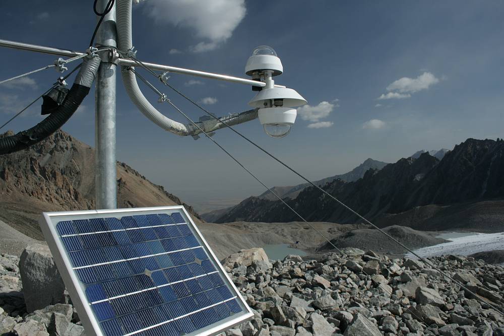
Meteorological station situated above the glacier at an elevation of 3 830 m above sea level
Hydrology
The hydrological regime of lakes in the Adygine area is being continuously monitored. The water level is measured by water gauges and a pressure water gauge was installed last year in the Adygine upper lake which automatically measures the water level fluctuations.
A current meter is used to measure the water discharge at the site of flow over the dam of the upper lake. These measurements can only be carried out during the summer months because in the period from October to April the water does not flow out from the lake.
Bathymetric measurements undertaken in 2005 were repeated this year
Glaciology
The retreat of the Adygine glacier above the lakes is periodically monitored by surveying its edge and two marked profiles on its surface. Poles will be installed on the glacier at the end of winter in order to measure oscillations of its surface. The thickness of snow and its temperature are measured during the winter period. The soil temperature in front of the glacier is measured by five temperature sensors with data loggers.
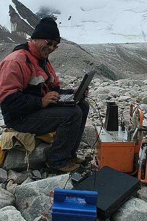
The data acquired from automatic instruments are transmitted and inserted into a computer and analogously subtracted data are also stored in a notebook, which is available at the research station.