

ADYGINE LOCALITY 
The Adygine locality, its characteristics
The Adygine morraine-glacier complex lies in the Ala-Archa National Park, ca 40 km south of the capital of Bishkek
The locality is relatively fairly accessible and has been described in several reports from the past when it was studied by ground and aerial monitoring. Its character is representative enough to allow the results of monitoring and investigation to apply to the whole area of the Kyrgyz mountain range and/or on other mountain ranges of northern Kyrgyzstan. The future results can also be correlated with similar studies in other high mountains worldwide.
The Adygine glacier
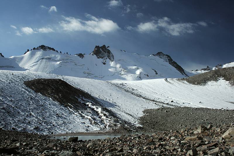
The locality is built by a glacier-moraine complex lying at an altitude of 3 400 – 4 200 m above sea level. The huge moraine consisting of a few generations of glacial till is about 3.5 km long. The apical part of the locality is covered by a glacier extending as far as the summit of the Kyrgyz mountain range (Kyrgyz Ala-Too).
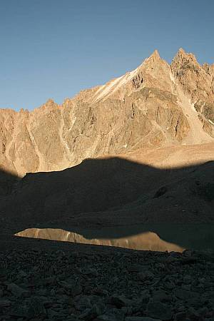
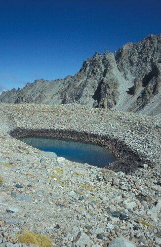
A few types of lakes originated below the glacier’s edge in the upper part of the moraine. Altogether 22 lakes currently occur at the locality among which glacial, glacial/moraine and thermokarst lakes and lakes partly dammed by a rock bar are most common. The Adygine upper lake having an area of 3.2 hectares and being 380 m long and 2.2. m deep is the largest lake at the locality. The majority of small lakes belong to thermokarst type and lie on the youngest generation of the moraine. Three new lakes began to originate during the last few years in front of the retreating glacier.
A few types of lakes originated below the glacier’s edge in the upper part of the moraine. Altogether 22 lakes currently occur at the locality among which glacial, glacial/moraine and thermokarst lakes and lakes partly dammed by a rock bar are most common. The Adygine upper lake having an area of 3.2 hectares and being 380 m long and 2.2. m deep is the largest lake at the locality. The majority of small lakes belong to thermokarst type and lie on the youngest generation of the moraine. Three new lakes began to originate during the last few years in front of the retreating glacier.
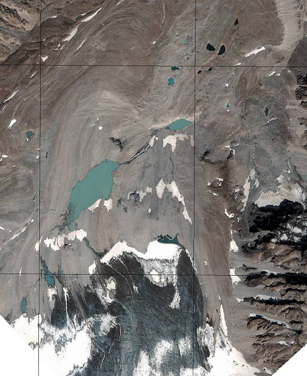
Satellite imagery of the Adygine complex (Quick Bird 2006)
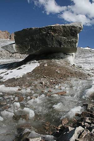
Three lakes are considered potentially dangerous. The development of lakes in front of the glacier is relatively fast and changes in their shape can be seen during each year. The Agydine glacier is thawing intensely which can be documented by the rate and of retreat including all other associated phenomena. Streams flowing down the glacier surface can be observed during the summer, fractures and small ice caves can also be observed. Frequent glacier tables originated by melted off ice around large boulders can also be seen.
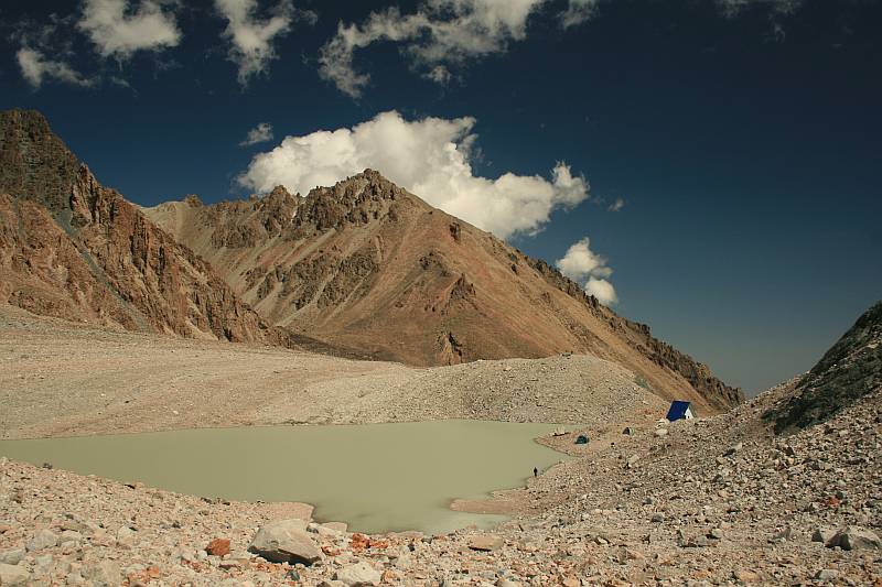
The Adygine upper lake
The Adygine locality can be reached from the main Ala-Archa valley through which runs an asphalt road. A trail for horses goes through a valley from the road as far as a place about 6 km away from the locality. Then it is necessary to climb along a rock cliff for other ca 200 m up the hill. This section is currently not passable for horses. However, following some landscaping the whole route up to the close proximity of the station can be made passable for horses. From here the station can be reached by less than two hours of walking. nahoru