


ENGINEERING GEOLOGY
GEOMIN company is engaged since its establishment in a relatively wide scope of engineering geological problems. The activities in this field are managed by our specialists having been certified by the Ministry of Environment to project, perform and evaluate the geological work in the field of engineering geology.
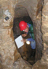
Engineering-geological unvestigations for all types of building structures and foundation techniques
Compilation of engineering-geological maps for the territorial planning and risk management. The maps also make part of the grounds for environmental studies and projects of line structures (roads, water supply systems, pipelines, tunnels).
-
Compilation of maps on medium scales (1:50000,1:25000) as well as of detailed maps (on a scale of 1:10000, 1:5000 and smaller scales)
-
Retrieval of engineering-geological data
-
Exploitation of satellite photographs
-
Exploitation of airborne photographs
-
Compilation of maps of explored areas
-
Compilation of maps of exploration works
-
Compilation of engineering-geological maps
-
Compilation of maps of engineering-geological zoning
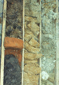
Sampling, physical and chemical testing of soil samples, physical and chemical analyses of water samples
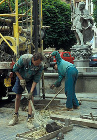
Studies for various purposes for construction projects (for the preparation of industrial zones, for the monitoring of engineering-geological conditions of historical town centres) and at areas of differing size.
-
Construction site assessment
-
For the purposes of construction projects
-
Grounds for the land use planning
-
Assessment of specific engineering-geological problems (undermining, underground space,...)
-
Assessment of effects of natural conditions on foundation
GEOMIN carries out all stages of engineering-geological investigation, from preliminary to detailed investigation.
-
Construction site stability and suitability
-
Geological structure of underlying bed below the construction site
-
Determination of physical and mechanical characteristics of foundation soils
-
Groundwater effect on foundation
Recommendation of foundation technique and assessment of the building structure´s supposed effect on the surrounding objects
Investigation for railways, roads, piping structures (gas pipelines, oil pipelines, water supply systems) joins the methodologies of classical engineering-geological mapping and zoning and classical engineering-geological investigation.
Provides information on the changes of engineering-geological conditions in the linear structure route.
Provides information for foundation of associated objects (bridges, underpasses, masts,...)
-
Assessment of materials for fills
-
Assessment of underlayer below railways and roadways
-
Investigations for dam construction purposes
-
Investigations of borrow pits of sealing and stabilizing soils
-
Průzkumy pro stanovení stability svahů po obvodu záplavy
-
Determination of physical and mechanical characteristics of soils and rocks.
Slope stability assessment as part of a wide range of engineering-geological investigations – traffic engineering, pipeline routes, embankment and fill slopes, cut slopes, foundation pit slopes...
- Mapping of landslides
- Identification of reasons for landslides
- Slope designs
- Design of slide prevention measures
- Proposals for erosion prosesses mitigation